LSSTApplications  10.0+286,10.0+36,10.0+46,10.0-2-g4f67435,10.1+152,10.1+37,11.0,11.0+1,11.0-1-g47edd16,11.0-1-g60db491,11.0-1-g7418c06,11.0-2-g04d2804,11.0-2-g68503cd,11.0-2-g818369d,11.0-2-gb8b8ce7
LSSTDataManagementBasePackage
Public Member Functions | Private Member Functions | Private Attributes | List of all members
lsst.skymap.tractInfo.ExplicitTractInfo Class Reference
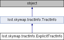
Inheritance diagram for lsst.skymap.tractInfo.ExplicitTractInfo:
lsst.skymap.tractInfo.TractInfo

Public Member Functions

def __init__
 
- Public Member Functions inherited from lsst.skymap.tractInfo.TractInfo
def __init__
 
def findPatch
 
def findPatchList
 
def getBBox
 
def getCtrCoord
 
def getId
 
def getNumPatches
 
def getPatchBorder
 
def getPatchInfo
 
def getPatchInnerDimensions
 
def getTractOverlap
 
def getVertexList
 
def getWcs
 
def __str__
 
def __repr__
 
def __iter__
 
def __len__
 
def __getitem__
 

Private Member Functions

def _minimumBoundingBox
 

Private Attributes

 _radius
 

Detailed Description

Information for a tract specified explicitly

A tract is placed at the explicitly defined coordinates, with the nominated
radius.  The tracts are square (i.e., the radius is really a half-size).

Definition at line 306 of file tractInfo.py.

Constructor & Destructor Documentation

def lsst.skymap.tractInfo.ExplicitTractInfo.__init__ (   self,
  ident,
  patchInnerDimensions,
  patchBorder,
  ctrCoord,
  radius,
  tractOverlap,
  wcs 
)

Definition at line 312 of file tractInfo.py.

313  def __init__(self, ident, patchInnerDimensions, patchBorder, ctrCoord, radius, tractOverlap, wcs):
314  vertexList = []
315  self._radius = radius
316  super(ExplicitTractInfo, self).__init__(ident, patchInnerDimensions, patchBorder, ctrCoord,
317  vertexList, tractOverlap, wcs)

Member Function Documentation

def lsst.skymap.tractInfo.ExplicitTractInfo._minimumBoundingBox (   self,
  wcs 
)
private
The minimum bounding box is calculated using the nominated radius

Definition at line 318 of file tractInfo.py.

319  def _minimumBoundingBox(self, wcs):
320  """The minimum bounding box is calculated using the nominated radius"""
321  bbox = afwGeom.Box2D()
322  for i in range(4):
323  coord = self._ctrCoord.clone()
324  coord.offset(i * 90 * afwGeom.degrees, self._radius + self._tractOverlap)
325  pixPos = wcs.skyToPixel(coord)
326  bbox.include(pixPos)
327  return bbox
328 
A floating-point coordinate rectangle geometry.
Definition: Box.h:271

Member Data Documentation

lsst.skymap.tractInfo.ExplicitTractInfo._radius
private

Definition at line 314 of file tractInfo.py.


The documentation for this class was generated from the following file: