Public Member Functions | |
| def | __init__ (self, id, patchInnerDimensions, patchBorder, ctrCoord, vertexCoordList, tractOverlap, wcs) |
| def | getSequentialPatchIndex (self, patchInfo) |
| def | getPatchIndexPair (self, sequentialIndex) |
| def | findPatch (self, coord) |
| def | findPatchList (self, coordList) |
| def | getBBox (self) |
| def | getCtrCoord (self) |
| def | getId (self) |
| def | getNumPatches (self) |
| def | getPatchBorder (self) |
| def | getPatchInfo (self, index) |
| def | getPatchInnerDimensions (self) |
| def | getTractOverlap (self) |
| def | getVertexList (self) |
| def | getInnerSkyPolygon (self) |
| def | getOuterSkyPolygon (self) |
| def | getWcs (self) |
| def | __str__ (self) |
| def | __repr__ (self) |
| def | __iter__ (self) |
| def | __len__ (self) |
| def | __getitem__ (self, index) |
| def | contains (self, coord) |
Detailed Description
Information about a tract in a SkyMap sky pixelization

Parameters
----------
id : `int`
    tract ID
patchInnerDimensions : `tuple` of `int`
    Dimensions of inner region of patches (x,y pixels).
patchBorder : `int`
    Overlap between adjacent patches (in pixels)
ctrCoord : `lsst.geom.SpherePoint`
    ICRS sky coordinate of center of inner region of tract; also used as
    the CRVAL for the WCS.
vertexCoordList : `list` of `lsst.geom.SpherePoint`
    Vertices that define the boundaries of the inner region.
tractOverlap : `lsst.geom.Angle`
    Minimum overlap between adjacent sky tracts; this defines the minimum
    distance the tract extends beyond the inner region in all directions.
wcs : `lsst.afw.image.SkyWcs`
    WCS for tract. The reference pixel will be shifted as required so that
    the lower left-hand pixel (index 0,0) has pixel position 0.0, 0.0.

Notes
-----
The tract is subdivided into rectangular patches. Each patch has the
following properties:

- An inner region defined by an inner bounding box. The inner regions of
  the patches exactly tile the tract, and all inner regions have the same
  dimensions. The tract is made larger as required to make this work.

- An outer region defined by an outer bounding box. The outer region
  extends beyond the inner region by patchBorder pixels in all directions,
  except there is no border at the edges of the tract.
  Thus patches overlap each other but never extend off the tract.
  If you do not want any overlap between adjacent patches then set
  patchBorder to 0.

- An index that consists of a pair of integers:

  * 0 <= x index < numPatches[0]

  * 0 <= y index < numPatches[1]

  Patch 0,0 is at the minimum corner of the tract bounding box.

- It is not enforced that ctrCoord is the center of vertexCoordList, but
  SkyMap relies on it.
Definition at line 34 of file tractInfo.py.
Constructor & Destructor Documentation
◆ __init__()
| def lsst.skymap.tractInfo.TractInfo.__init__ | ( | self, | |
| id, | |||
| patchInnerDimensions, | |||
| patchBorder, | |||
| ctrCoord, | |||
| vertexCoordList, | |||
| tractOverlap, | |||
| wcs | |||
| ) |
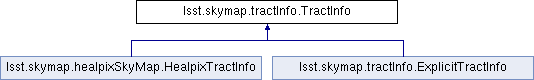
Reimplemented in lsst.skymap.tractInfo.ExplicitTractInfo.
Definition at line 85 of file tractInfo.py.
Member Function Documentation
◆ __getitem__()
| def lsst.skymap.tractInfo.TractInfo.__getitem__ | ( | self, | |
| index | |||
| ) |
Definition at line 405 of file tractInfo.py.
◆ __iter__()
| def lsst.skymap.tractInfo.TractInfo.__iter__ | ( | self | ) |
Definition at line 395 of file tractInfo.py.
◆ __len__()
| def lsst.skymap.tractInfo.TractInfo.__len__ | ( | self | ) |
Definition at line 401 of file tractInfo.py.
◆ __repr__()
| def lsst.skymap.tractInfo.TractInfo.__repr__ | ( | self | ) |
Definition at line 392 of file tractInfo.py.
◆ __str__()
| def lsst.skymap.tractInfo.TractInfo.__str__ | ( | self | ) |
Definition at line 389 of file tractInfo.py.
◆ contains()
| def lsst.skymap.tractInfo.TractInfo.contains | ( | self, | |
| coord | |||
| ) |
Does this tract contain the coordinate?
Definition at line 408 of file tractInfo.py.
◆ findPatch()
| def lsst.skymap.tractInfo.TractInfo.findPatch | ( | self, | |
| coord | |||
| ) |
Find the patch containing the specified coord.

Parameters
----------
coord : `lsst.geom.SpherePoint`
    ICRS sky coordinate to search for.

Returns
-------
result : `lsst.skymap.PatchInfo`
    PatchInfo of patch whose inner bbox contains the specified coord

Raises
------
LookupError
    If coord is not in tract or we cannot determine the
    pixel coordinate (which likely means the coord is off the tract).
Definition at line 203 of file tractInfo.py.
◆ findPatchList()
| def lsst.skymap.tractInfo.TractInfo.findPatchList | ( | self, | |
| coordList | |||
| ) |
Find patches containing the specified list of coords.

Parameters
----------
coordList : `list` of `lsst.geom.SpherePoint`
    ICRS sky coordinates to search for.

Returns
-------
result : `list` of `lsst.skymap.PatchInfo`
    List of PatchInfo for patches that contain, or may contain, the
    specified region. The list will be empty if there is no overlap.

Notes
-----
**Warning:**

- This may give incorrect answers on regions that are larger than a
  tract.

- This uses a naive algorithm that may find some patches that do not
  overlap the region (especially if the region is not a rectangle
  aligned along patch x,y).
Definition at line 233 of file tractInfo.py.
◆ getBBox()
| def lsst.skymap.tractInfo.TractInfo.getBBox | ( | self | ) |
◆ getCtrCoord()
| def lsst.skymap.tractInfo.TractInfo.getCtrCoord | ( | self | ) |
Get ICRS sky coordinate of center of tract
(as an lsst.geom.SpherePoint)
Definition at line 283 of file tractInfo.py.
◆ getId()
| def lsst.skymap.tractInfo.TractInfo.getId | ( | self | ) |
Get ID of tract
Definition at line 289 of file tractInfo.py.
◆ getInnerSkyPolygon()
| def lsst.skymap.tractInfo.TractInfo.getInnerSkyPolygon | ( | self | ) |
Get inner on-sky region as a sphgeom.ConvexPolygon.
Definition at line 368 of file tractInfo.py.
◆ getNumPatches()
| def lsst.skymap.tractInfo.TractInfo.getNumPatches | ( | self | ) |
Get the number of patches in x, y.

Returns
-------
result : `tuple` of `int`
    The number of patches in x, y
Definition at line 294 of file tractInfo.py.
◆ getOuterSkyPolygon()
| def lsst.skymap.tractInfo.TractInfo.getOuterSkyPolygon | ( | self | ) |
Get outer on-sky region as a sphgeom.ConvexPolygon
Definition at line 374 of file tractInfo.py.
◆ getPatchBorder()
| def lsst.skymap.tractInfo.TractInfo.getPatchBorder | ( | self | ) |
Definition at line 304 of file tractInfo.py.
◆ getPatchIndexPair()
| def lsst.skymap.tractInfo.TractInfo.getPatchIndexPair | ( | self, | |
| sequentialIndex | |||
| ) |
Definition at line 197 of file tractInfo.py.
◆ getPatchInfo()
| def lsst.skymap.tractInfo.TractInfo.getPatchInfo | ( | self, | |
| index | |||
| ) |
Return information for the specified patch.

Parameters
----------
index : `tuple` of `int`
    Index of patch, as a pair of ints;
    or a sequential index as returned by getSequentialPatchIndex;
    negative values are not supported.

Returns
-------
result : `lsst.skymap.PatchInfo`
    The patch info for that index.

Raises
------
IndexError
    If index is out of range.
Definition at line 307 of file tractInfo.py.
◆ getPatchInnerDimensions()
| def lsst.skymap.tractInfo.TractInfo.getPatchInnerDimensions | ( | self | ) |
Get dimensions of inner region of the patches (all are the same)
Definition at line 348 of file tractInfo.py.
◆ getSequentialPatchIndex()
| def lsst.skymap.tractInfo.TractInfo.getSequentialPatchIndex | ( | self, | |
| patchInfo | |||
| ) |
Return a single integer that uniquely identifies the given patch
within this tract.
Definition at line 189 of file tractInfo.py.
◆ getTractOverlap()
| def lsst.skymap.tractInfo.TractInfo.getTractOverlap | ( | self | ) |
Get minimum overlap of adjacent sky tracts.
Definition at line 353 of file tractInfo.py.
◆ getVertexList()
| def lsst.skymap.tractInfo.TractInfo.getVertexList | ( | self | ) |
Get list of ICRS sky coordinates of vertices that define the
boundary of the inner region.

Notes
-----
**warning:** this is not a deep copy.
Definition at line 358 of file tractInfo.py.
◆ getWcs()
| def lsst.skymap.tractInfo.TractInfo.getWcs | ( | self | ) |
Get WCS of tract.

Returns
-------
wcs : `lsst.afw.geom.SkyWcs`
    The WCS of this tract
Definition at line 379 of file tractInfo.py.
The documentation for this class was generated from the following file:
- /j/snowflake/release/lsstsw/stack/lsst-scipipe-0.7.0/Linux64/skymap/22.0.1-4-g037fbe1+64e601228d/python/lsst/skymap/tractInfo.py